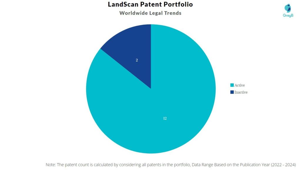
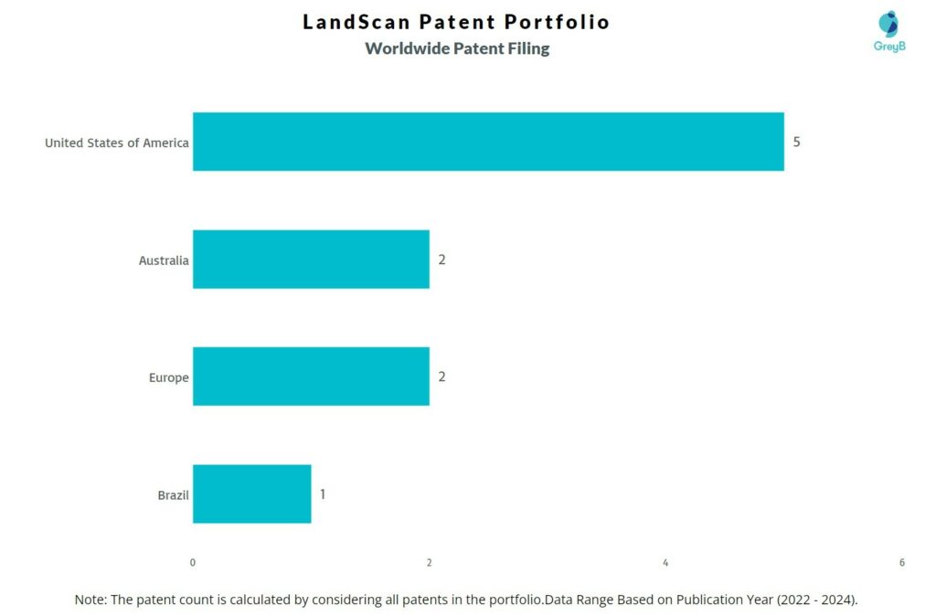
LandScan has a total of 14 patents globally, out of which 5 have been granted. Of these 14 patents, more than 85% patents are active. The United States of America is where LandScan has filed the maximum number of patents, followed by Australia and Europe (EPO). Parallelly, The United States of America seems to be the main focused R&D center and also the origin country of LandScan.
LandScan was founded in the year 2019. LandScan is dedicated to building information infrastructure tailored for the agricultural sector.
Do read about some of the most popular patents of LandScan which have been covered by us in this article and also you can find LandScan patents information, the worldwide patent filing activity and its patent filing trend over the years, and many other stats over LandScan patent portfolio.
How many patents does LandScan have?
LandScan has a total of 14 patents globally. These patents belong to 5 unique patent families. Out of 14 patents, 12 patents are active.
How Many Patents did LandScan File Every Year?
The company has 14 patents and correspondingly the filing year is 2021 and 2022.
How many LandScan patents are Alive/Dead?
Worldwide Patents

How Many Patents did LandScan File in Different Countries?

Countries in which LandScan Filed Patents
| Country | Patents |
| United States of America | 5 |
| Australia | 2 |
| Europe (EPO) | 2 |
| Brazil | 1 |
Where are Research Centers of LandScan Patents Located?
The Research Centre for all the LandScan patents is the United States of America.
What Percentage of LandScan US Patent Applications were Granted?
LandScan (Excluding its subsidiaries) has filed 5 patent applications at USPTO so far (Excluding Design and PCT applications). Out of these 2 have been granted leading to a grant rate of 100 %.
Below are the key stats of LandScan patent prosecution at the USPTO.

Which Law Firms Filed Most US Patents for LandScan?
| Law Firm | Total Applications | Success Rate |
| Downs Rachlin Martin | 5 | 100.0% |
List of LandScan Patents
| LandScan Patents | Title |
| US11800246B2 | Systems And Methods For Multispectral Landscape Mapping |
| US11686676B2 | In-Situ Near Infrared Sensor Unit And Method Of Making The Same |
| US20230065690A1 | Soil Penetrating Probe And System For Measuring Electrical Properties To Determine Soil Water Content |
| US20220317107A1 | Precision Site Characterization Using Digital Twin |
| US20220051118A1 | Site Characterization For Agriculture |
| EP4298430A1 | In-Situ Near Infrared Sensor Unit And Method Of Making The Same |
| EP4196934A1 | Site Characterization For Agriculture |
| WO2023149963A1 | Systems And Methods For Multispectral Landscape Mapping |
| WO2023028113A1 | Soil Penetrating Probe And System For Measuring Electrical Properties To Determine Soil Water Content |
| AU2022226316A1 | In-Situ Near Infrared Sensor Unit And Method Of Making The Same |
| AU2021329306A1 | Site Characterization For Agriculture |
| BR112023002989A2 | Characterization Of Site For Agriculture |
| WO2022183124A1 | In-Situ Near Infrared Sensor Unit And Method Of Making The Same |
| WO2022040192A1 | Site Characterization For Agriculture |
What are LandScan key innovation segments?
What Technologies are Covered by LandScan?

The chart below distributes patents filed by LandScan
